Fishing Maps
-
 Fish-n-Map®Lake Powell Fishing MapLake Powell Fishing Map by Fish-n-Map®. This product is made of high-quality materials to serve you for years to come. Designed using state-of-the-art technology and with customers in mind. It will meet your needs and deliver great...High quality at an affordable priceExpertly made from premium materials$10.81
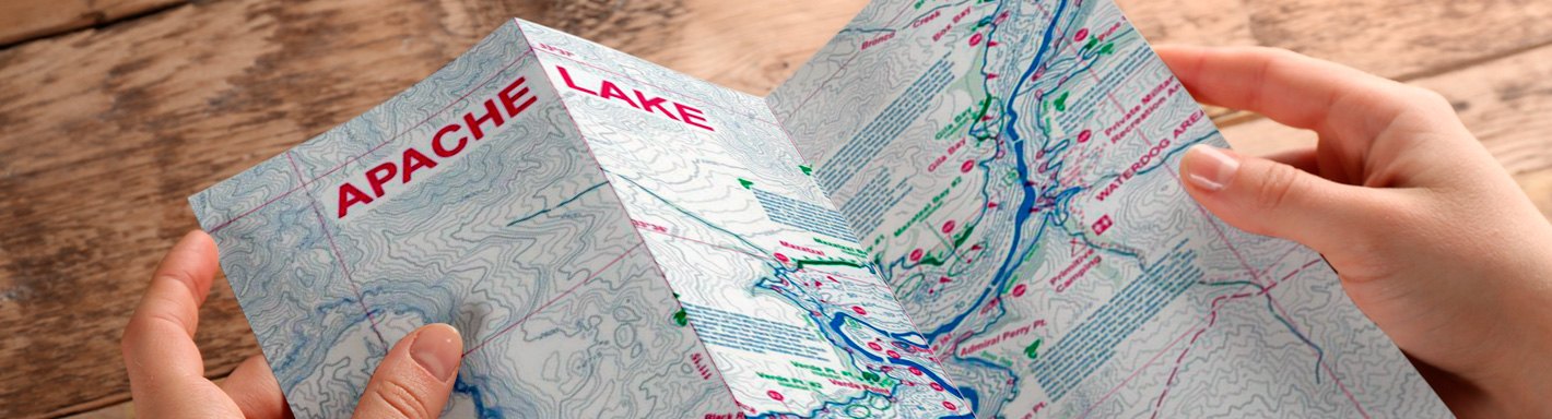
 - Fish-n-Map®Apache/Canyon/Saguaro Fishing Map (052025)Apache/Canyon/Saguaro Fishing Map by Fish-n-Map®. Apache/Canyon Saguaro - April 2020 Updates: Improved longitude and latitude grids using NAD 83 for datum, Updated GPS Locations, Improved outline of lakes, Added both natural and...3 Reservoirs on one map10 foot underwater depth contours$10.81
- Fish-n-Map®Bartlett/Horseshoe Fishing Map (052032)Bartlett/Horseshoe Fishing Map by Fish-n-Map®. Underwater Topography Map. Bartlett and Horseshoe Reservoirs, Updated February 2018. Additions and Improvements to Fish-n-Map Company's Bartlett & Horseshoe Reservoirs map #052032: Added...2 reservoirs on one map5-foot underwater depth contours$10.81
- Fish-n-Map®Catalina Island/Long Beach Fishing Map (041180)Catalina Island/Long Beach Fishing Map by Fish-n-Map®. Dana Point. to Santa Monica Bay. Catalina Island/Long Beach - Dana Point to Santa Monica Bay. Updated With 2011 Marine Sanctuaries! Printed on a Waterproof, Tear-resistant plastic.NUMEROUS FISHING SUGGESTIONS with GPS Coordinates provided2011 Marine Sanctuaries Identified$24.31
- Fish-n-Map®Channel Islands/Ventura Fishing Map (041197)Channel Islands/Ventura Fishing Map by Fish-n-Map®. Pt. Dume to Pt. Conception. This top-grade product is expertly made in compliance with stringent industry standards to offer a fusion of a well-balanced design and high level of...Channel Islands/Ventura Charts30 Foot Underwater Depth Contours$10.81
- Fish-n-Map®Don Pedro/Pardee/New Hogan Fishing Map (082664)Don Pedro/Pardee/New Hogan Fishing Map by Fish-n-Map®. Don Pedro Lake, Pardee Lake and New Hogan Lake - 3 lakes on one map. Updated May 2019: Additions and Improvements to Fish-n-Map Company's Don Pedro/Pardee/New Hogan map #082664,...Underwater Depth Contours for Easy "Structure" IdentificationMultiple Fishing Locations with GPS Coordinates Provided$10.81
- Fish-n-Map®L.A. & Orange County Inshore Charts Fishing Map (041234)L.A. & Orange County Inshore Charts Fishing Map by Fish-n-Map®. This top-grade product is expertly made in compliance with stringent industry standards to offer a fusion of a well-balanced design and high level of craftsmanship....L.A. and Orange County Inshore Charts (Point Dume to Dana Point)NUMEROUS fishing locations with GPS coordinates provided$10.81
- Fish-n-Map®Lake Havasu Fishing Map (032041)Lake Havasu Fishing Map by Fish-n-Map®. Lake Havasu, Parker Dam to Davis Dam. February 2018 Updates: Added natural fish habitat (rocky) plus added additional artificial habitat where needed. Improvements have been made to the suggested...Features fish habitat enhancement programFisheries Improvement project!$10.81
- Fish-n-Map®Lake Mead Fishing Map (032058)Lake Mead Fishing Map by Fish-n-Map®. October 2020 Updates: Added Fish Habitat including: Moderate Submerged Brush, Heavy Submerged Brush, Fair Rock Rubble Reefs, Good Rock Rubble Reefs, Shoreline, features: Gravel, Rocky, Rock Wall,...30 foot underwater depth contoursNumerous GPS coordinates identified, latitude/longitude grids included$10.81
- Fish-n-Map®Lake Mohave Fishing Map (032065)Lake Mohave Fishing Map by Fish-n-Map®. Underwater Topography Map. Lake Mohave - Davis Dam to Hoover Dam. Updated June 2020: Additions and Improvements such as Fish Habitat: Fair Rock Rubble, Good Rock Rubble, Submerged Weedbeds....10 foot underwater depth contoursGPS locations and fish habitat areas identified. With longitude and latitude grids$10.81
- Fish-n-Map®Lake Pleasant/Lee's Ferry Fishing Map (052070)Lake Pleasant/Lee's Ferry Fishing Map by Fish-n-Map®. Lake Pleasant/Lee's Ferry (Colorado River below Lake Powell). This top-grade product is expertly made in compliance with stringent industry standards to offer a fusion of a...10 foot underwater depth contoursLatitude and longitude grids$10.81
- Fish-n-Map®Lake Powell North Fishing Map (032553)Lake Powell North Fishing Map (032553) by Fish-n-Map®. Colorado River Inlet through Escalante Arm. Lake Powell North - Colorado River Inlet through Escalante Arm. Waterproof, Tear-Resistant Plastic. Additions/Improvements to Fish-n-Map...NUMEROUS Fishing Locations with GPS Coordinates Provided!Fishing Strategy Included$10.81
- Fish-n-Map®Lake Powell South Fishing Map (032089)Lake Powell South Fishing Map (032089) by Fish-n-Map®. Wahweap to Escalante Arm, including San Juan Arm. Lake Powell South - Wahweap to Escalante Arm, Including San Juan Arm. Waterproof, Tear-Resistant Plastic. 2020 Updates: Added Fish...NUMEROUS Fishing Locations with GPS Coordinates Provided!Fishing Strategy Included$10.81
- Fish-n-Map®Lower Colorado River Fishing Map (042187)Lower Colorado River Fishing Map by Fish-n-Map®. Parker Dam to Yuma. Additions/Improvements to Fish-n-Map Company's Lower Colorado River map Updated February 2019. This top-grade product is expertly made in compliance with stringent...Updated the outline of the river using recent satellite dataThe Martinez Lake/Squaw Lake/Ferguson Lake/Imperial Dam/Fisher's Landing areas have been updated using recent aerial photos and has been more than doubled in size$10.81
- Fish-n-Map®Pt. Sal to Cape San Martin Fishing Map (081285)Pt. Sal to Cape San Martin Fishing Map by Fish-n-Map®. Pt. Sal to Cape San Martin. Morro Bay, Pt. Sal to Cape San Martin - Includes Morro Bay, San Simeon, Port San Luis, San Luis Obispo Bay and Pismo Beach. Numerous GPS coordinates...Marine Sanctuaries Identified5 foot underwater depth contours$10.81
- Fish-n-Map®Roosevelt Lake, AZ Fishing Map (052094)Roosevelt Lake, AZ Fishing Map by Fish-n-Map®. Updated May 2019: Additions and Improvements to Fish-n-Map Company's Roosevelt Lake (AZ) map #052094. Added fish habitat including submerged brush up to 55' deep, rock rubble reefs and...10 foot underwater depth contours for easy structure identificationNumerous GPS coordinates identified$10.81
- Fish-n-Map®Sea of Cortez North Fishing Map (071231)Sea of Cortez North Fishing Map by Fish-n-Map®. San Felipe to Mulege. Sea Of Cortez North (San Felipe to Mulege). Printed on a waterproof, tear-resistant plastic. This top-grade product is expertly made in compliance with stringent...30 Foot Underwater Depth Contours for Easy Structure IdentificationFishing Locations$10.81
- Fish-n-Map®Suisun Bay, Sacramento & San Joaquin Rivers Fishing Map (082688)Suisun Bay, Sacramento & San Joaquin Rivers Fishing Map by Fish-n-Map®. Additions and Improvements to Fish-n-Map Company's The Delta map, #082688, Updated August 2019: Updated the outline of the water boundaries and weedbeds in the Big...10 Foot Underwater Depth ContoursFish Holding Tule Plants & Brush Identified$10.81
- Fish-n-Map®Castaic/Piru/Pyramid Fishing Map (042125)Castaic/Piru/Pyramid Fishing Map by Fish-n-Map®. This top-grade product is expertly made in compliance with stringent industry standards to offer a fusion of a well-balanced design and high level of craftsmanship. Manufactured from...Perfect blend of leading innovations and superior workmanshipManufactured to offer high value and everlasting reliability$10.81
- Fish-n-Map®McClure/Eagle Lake/Lake Almanor Fishing Map (082718)McClure/Eagle Lake/Lake Almanor Fishing Map by Fish-n-Map®. This top-grade product is expertly made in compliance with stringent industry standards to offer a fusion of a well-balanced design and high level of craftsmanship....Perfect blend of leading innovations and superior workmanshipManufactured to offer high value and everlasting reliability$10.81
- Fish-n-Map®Silverwood/Perris/Skinner Fishing Map (042163)Silverwood/Perris/Skinner Fishing Map by Fish-n-Map®. This top-grade product is expertly made in compliance with stringent industry standards to offer a fusion of a well-balanced design and high level of craftsmanship. Manufactured from...Perfect blend of leading innovations and superior workmanshipManufactured to offer high value and everlasting reliability$10.81